← Elk River and Table Mound trails – Elk City Lake, Kansas
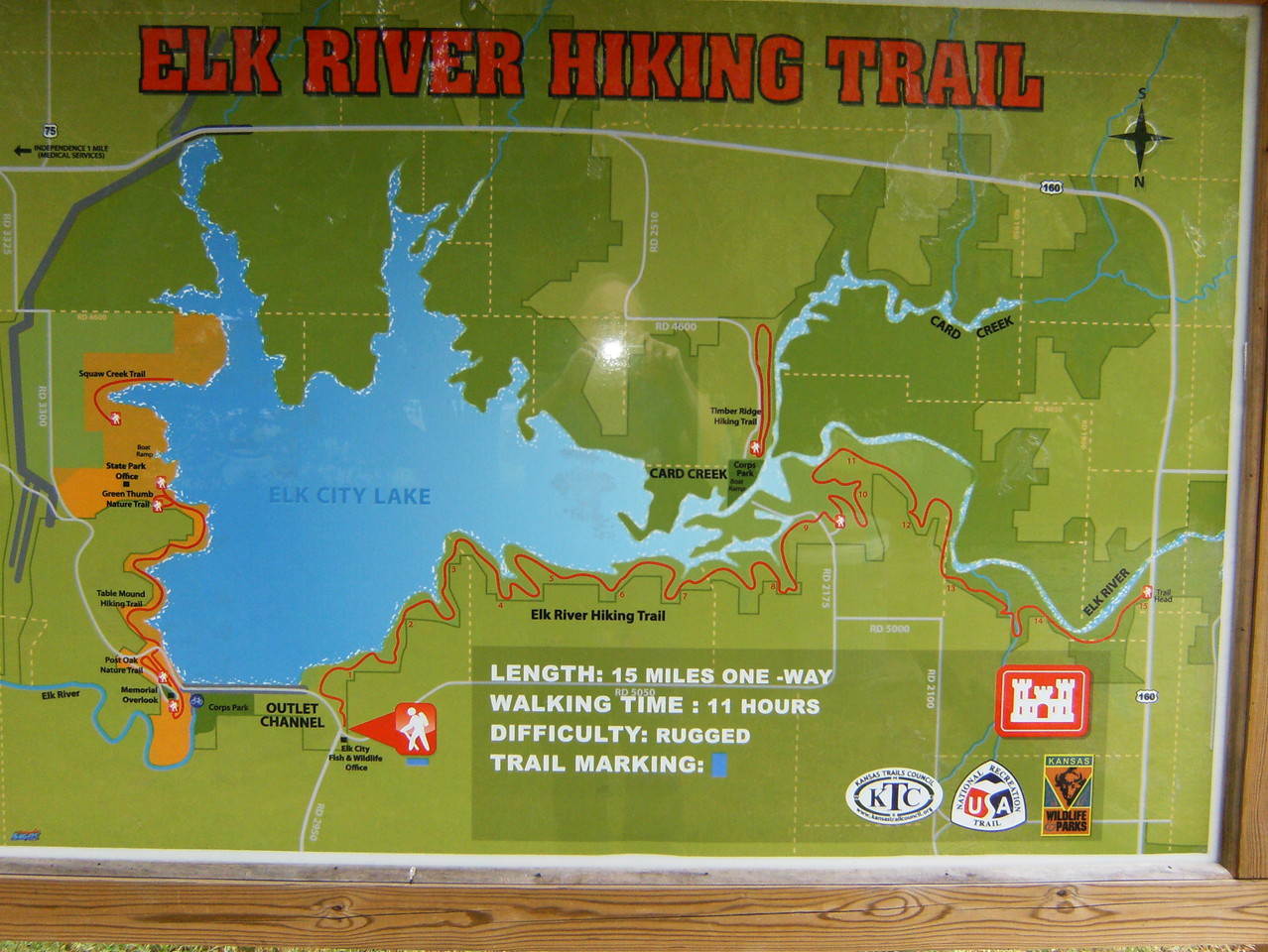
A photograph of the map at the trail head. South is at the top.
I am having a hard time finding a solid location for the trailhead. Can someone help? Thanks!
i figured out why I was confused about your map. It is printed upside down. It is not oriented north! If I flip my computer over, it works!
I disclaim responsibility for the map! It is odd that it’s upside-down.
Yes. Cartographers everywhere are cringing!
Why would you ever publish a map that is oriented with south on top and north on bottom?
In this case, I believe you’re facing south when looking at the map display so it kinda makes some sense.
I think it’s because the trail is marked east to west.
Δ


I am having a hard time finding a solid location for the trailhead. Can someone help? Thanks!
i figured out why I was confused about your map. It is printed upside down. It is not oriented north! If I flip my computer over, it works!
I disclaim responsibility for the map! It is odd that it’s upside-down.
Yes. Cartographers everywhere are cringing!
Why would you ever publish a map that is oriented with south on top and north on bottom?
In this case, I believe you’re facing south when looking at the map display so it kinda makes some sense.
I think it’s because the trail is marked east to west.