It was my third trip to Norfork Lake to hike and collect/verify map data for the Ozarks Keystone Trail (OKT), but this time I was backpacking with TC & RC. We covered the area from the Barren Creek trail head to Bidwell Point (north to south), leaving just 3.6 miles of finished trail north to the state line for a future visit. In addition to the OKT we did a round trip on the spur trails in the Seward Point unit of the Norfork Wildlife Management Area (WMA) for about 22 miles in all.
The only reliable source of water on this stretch of the trail is the lake. There was water flowing in several of the intermittent creeks we crossed (and we took advantage of that when we could) but there had been some rain the night before so I don’t know what normal conditions are.
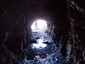
Once on the trail we quickly arrived in the Bean Bluff area, one of the more scenic and pleasant parts of the trail. Cedar groves, rocky ledges, and old zinc mines abound. Until you get close to the Red Bank area this is a nice walk in the woods, mostly out of sight of “civilization”. About a mile and a half south of Red Bank one enters the Norfork WMA – a large uninhabited tract that feels a lot like a wilderness area. If I lived closer I think I would spend a lot of time there. As it was, we spent both of our nights there – the first being in the Bald Knob area – at the end of an 8-mile day.
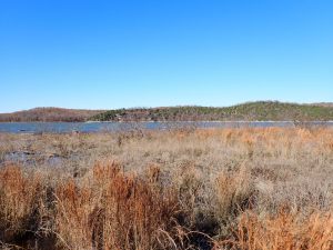
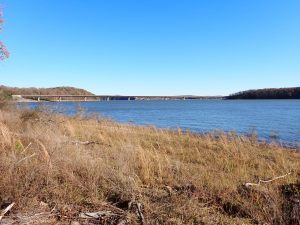
Day #2 had us continuing south to the Piney Point spur, an old road running 1.6 miles out to Seward Point and the edge of the lake. The high lake levels and almost-flat terrain put the water right up into the surrounding brush so there was no walking along the beach or snack stop at water’s edge this time. There were many places along this spur that looked like they would be good camp sites.
Back at the OKT, we continued south a short distance to the Mallard Ridge spur which leads 1.2 miles down to the lake. There’s a one-mile loop near the middle of the spur. We took the east branch on the way down to the lake. The terrain here has a bit of slope and the lake is very accessible so we were easily able to collect enough water to get us to the next day. We took the west side of the loop on the way back up and accidentally discovered there is another spur that isn’t on my maps and could lead one astray if one ignores the clues they are going the wrong direction (like we did). Our detour added another mile to what we thought would be a short 6-mile day but we found a nice flat area just before getting back to the OKT where we made camp #2. Update: I published updated maps on Nov 28 2024 that include part of this new spur.
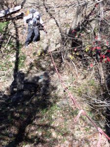
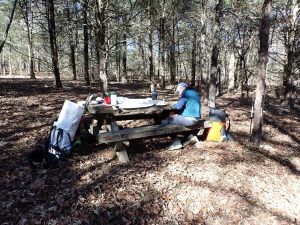
On day #3 we got back to the OKT and continued south once again, eventually exiting the WMA and seeing a bit more civilization in the form of roads, houses, and boat docks. It’s mostly still a nice walk in the woods. One area features a steep ravine with climbing ropes to assist and just 100′ later you cross a tram line used by one of the resorts. In the final three miles there is a picnic table about every mile making a nice place for a break.