
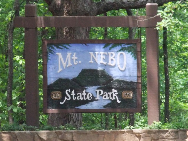
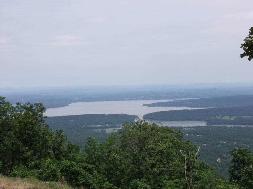
Located a few miles southwest of Russellville Arkansas and rising about 1300′ above its surroundings, Mount Nebo State Park is not a big one but does offer some pretty nice scenery, great vistas, good day hiking, camping, mountain biking, and interesting geology.
The visitor center is at 35.2278°N, 93.2561°W. Historically, the main attractions (for a hiker) were the Rim and Bench trails but several years ago some new hike/bike trails were built. The trails are interconnected in a way that you can make a hike of just about any length with as much (or as little) elevation change as desired.
Hike-only Trails
The Rim Trail (3.25 miles) is the star of the show, encircling the top of the mountain as it winds up and down through a bluff. Scenic vistas abound, as does CCC handiwork. The trail has some very easy parts and some surprisingly challenging parts.
The Bench Trail (3.75 miles) is an old road that circles the mountain, on a mostly-natural bench about 200′ below the rim. With probably no more than 50′ of elevation change over its length it’s a pretty easy hike. There are numerous springs and a pond along the way. There are 10 walk-in camp sites along this trail (permit required). Use Miller’s Goat (see below) for the gap between the Bench Overlook and the Bench Trail parking areas. The area is thickly wooded so the only scenic vistas are the Bench Overlook and a power line cut a bit west of there.
A sign that is now gone said “Known in the 1890s as Bench Boulevard, the Bench had a hotel, homes, and stores as did the mountaintop. Gazebos awaited guests at each of the springs as well as Fern Lake where visitors would socialize and enjoy the beautiful scenery and cooler temperatures.”
The Summit Park Trail (1 mile depending), mostly runs parallel to and between the Bench and Rim trails on the west side. At each end there is a connector between the Bench & Rim trails.
The Gum Springs Trail (0.4 miles) is a connector on the west side between the Rim Trail at the Gum Springs parking area and the Bench Trail. The trail passes along the top and the base of 32′ Mount Nebo Falls (normally dry).
The Nebo Springs Trail (0.25 miles) is a connector on the east side between the Rim Trail and the Bench Trail near Nebo Springs. Additionally, there is a short loop that descends below the Bench Trail to the spring itself.
The Nebo Steps Trail (0.15 miles) is a connector on the east side between the Rim Trail behind the Visitor Center and the Bench Trail.
The Varnall Springs Trail (0.3 miles ) is a connector on the east side between the Rim Trail and the Bench Trail. In addition, there is a spur that descends below the Bench Trail to two springs.
Bench Road Connector (0.25) is a service road at the north/west end that connects the Rim and Bench trails.
These 7 connectors between the Rim and Bench trails tend to be steep and can really add some challenge to the hike. A favorite route is to park at the Bench Trail parking lot and do 2 laps around the mountain, taking each connector as I come to it, alternating between the Bench and Rim Trails.
Bike & Hike Trails
A whole system of trails were built for mountain bikers (2018-19?) and are open to hikers as well. The ratings below are “Modified IMBA” designations.
Miller’s Goat, 5.3 mile loop, rated moderate. Roughly parallels the Bench Trail but with lots of ups and downs. The maximum elevation difference for the trail is about 250′. Access from Bench Trail trail head, or from Sunset Point via the Sunset Point Connector.
Ox Pull, 1.7 miles, rated intermediate, bikers are allowed to go only uphill. Runs between the AR-155 trail head and the Bench Trail with about 800′ elevation change (8.67% avg grade). This is my favorite trail for conditioning.
Chickalah Valley Loop, a lollipop with a 1.1 mile stem and a 4.1 mile loop – so a 6.3-mile round-trip. Rated intermediate. Lies in the northwestern part of the park, in an area few people visited before the trail was built. Peaceful and secluded. This is a favorite for a nice walk in the woods. The SW corner along Little Chickalah Creek has great watery scenery while the NE corner has views of Lake Dardenelle from a high bluff. About 550′ max elevation change. Access from Sunset Point via the Sunset Point Connector. Intersects the Bench and Miller’s Goat trails at the top. There is a trail generally called “the extraction road” that runs through here. It is rated easy but there is a very steep climb coming out. This was built from old logging/fire roads and is also used by the rescue crew.
Lizard Tail, 1.9 miles, rated very hard. Runs between Sunrise and Sunset Points around the west side of the mountain, below the Rim Trail. About 200′ max elevation change.
Sunrise Loop, 1 mile, rated hard. Lies between the Rim and Bench Trails below Sunrise Point. About 300′ max elevation change.
Sunset Point Connector, 0.5 miles, rated moderate. Zig-zags down the slope from the Rim Trail near Sunset Point, crossing the Bench Trail before intersecting Miller’s Goat at the top end of the Chickalah Valley Loop.
Three-Cs Trail, 1.8 miles, rated easy. Runs between Sunrise and Sunset Points on top of the mountain. Very little elevation change.
Bike-only and downhill-only trails
Chickalah Downhill, 2.3 miles, rated intermediate.
Hayes Creek Run, 2.1 miles, rated very hard.
Evan’s Escape, rated hard.
Jacoway Run, rated hard.
Haney’s Ridge, rated very hard.
Map
I have 2 maps, each 2 pages, targeted at different paper sizes and hence different scales. Here’s some general info about my maps. Every time I update a map the file will have a different name so if you want to bookmark or share it, link to this page – not the file.
The 8.5×11″ set covers the core trails at 1:12000 scale on page 1 and Chickalah Valley trails at 1:10000 on page 2.
The less crowded 11×17″ set covers the core trails at 1:9000 scale on page 1 and Chickalah Valley trails at 1:6000 on page 2.
v6, Oct 27 2025: Added outlines for many buildings and Lizard Tail trail. The hiking-only trails are now colored like their blazes and the park map. The hike & bike trails are restyled to resemble their “Modified IMBA” rating.
v5, Jan 28 2025: Minor style updates.
Photos


Last review/update: Oct 28 2025


