
The Shady Lake Trail, Tall Peak Trail, and others originate in the Shady Lake Recreation Area. The rec area is a big fully-featured one accomodating tents, RVs, and trailers. There are electric and water hookups, bathrooms, showers, swimming beach, day use area, etc. The entrance to the rec area is at 34.3640°N 94.0258°W.
The rec area is closed (and the entrance gated) from Dec 1 to mid-March though the trails are open year-round.
Maps
Here’s some general info about my maps. Every time I update the map the file will have a different name so if you want to bookmark or share it, link to this page – not the file.
My map is a 1-page PDF that will be about 1:10000 scale on 11×17″ paper.
Nov 29 2025, v4: The tracks for the Shady Lake & Tall Peak trails are now from data I collected myself instead of using data from USFS (which was very wrong for the Tall Peak Trail).
Trails
The main trail head for the Shady Lake and Tall Peak trails is at the southwest corner of camp loop C at 34.3679°N 94.0318°W. There is some unofficial day use parking along the edge of the road nearby. The trail immediately crosses a concrete slab over which the Saline River flows. The normal water level is no more than a few inches but that might still be too much to keep the socks dry so be prepared.
An alternative is a spur from the north end of camp loop C at 34.3703°N 94.0304°W that leads 200′ out to the Shady Lake Trail. There is a river crossing 300′ west where you can rock-hop.
There are also various places where you can pull off the road north of the rec area to get access to the Tall Peak Trail with fewer water crossings.
The Tall Peak Trail is a 6.4 mile out-and-back, mostly in the Caney Creek Wilderness. It heads north along the river – with 5 crossings – before turning west to begin climbing and then northwest to an intersection with a road that spirals the final 0.2 miles to the top of Tall Peak. The climb is about 1200′ with the top at about 2320′. At the top is a historic fire watch tower with a view mostly to the less-scenic south – including Shady Lake. The road that goes 2 miles to the top is gated so you can’t drive up. May ’14 trip report. Tim Ernst has a good description of the hike.
The trail is blazed with yellow paint on the trees. I found during a Nov ’25 trip that the blazes had faded considerably. I lost the trail twice, the recent leaf fall undoubtedly exacerbating the issue.
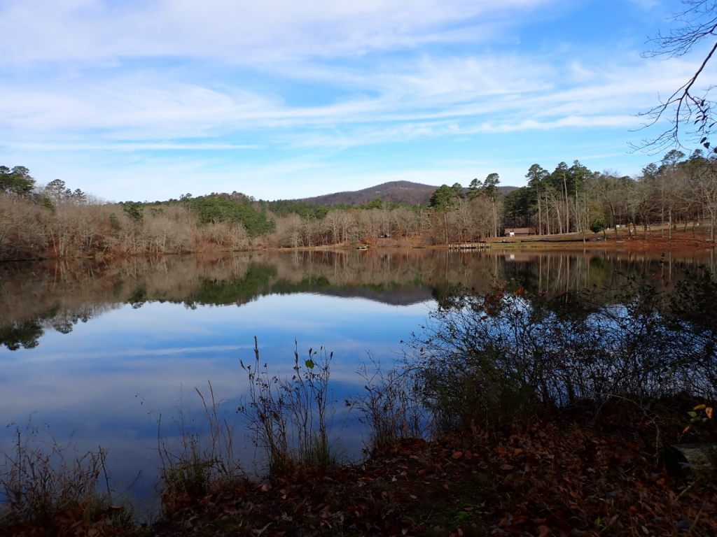
The Shady Lake Trail is a 3.6 mile loop around the lake. Mountain bikes are allowed. On the east side there are several ways that can be shortened if you don’t mind some road-walking. The trail is blazed with white paint on the trees. I found during a Nov ’25 trip that the blazes were pretty fresh and visible.
The 500′ of trail below the dam – squeezed between the road and the river – is scenic but pretty rugged with a lot of brush and loose rock. It’s unlikely you’ll get through this stretch with a bike. The Saline River is crossed a little below the place where a foot bridge used to be. Rock-hopping is possible at normal levels.
There is another crossing of Saline River at the north end of the trail where rock-hopping is normally possible. At the crossings of East Saline Creek and South Fork Saline River, the trail connects to the road where you can cross on the bridge before veering back onto the trail.
The Valuable Forest Trail is a short interpretive loop that runs along East Saline Creek. The part on the east side of the creek is shared with the Shady Lake Trail. I have not hiked the part on the west side of the creek and can’t confirm that the path shown on the map is correct or that the trail still exists.
The Viles Branch Trail begins at the southeast corner of the rec area and follows the path of FR 502 1.5 miles to its gated end. The trail continues east about 1.3 miles to a junction with the Athens-Big Fork Trail, then the next 3.7 miles form the southern end of the Eagle Rock Loop. Some documents suggest that the trail continues several miles farther east of the ERL but I have no data on that yet. This has long been known as an equestrian trail but equestrians are apparently no longer allowed to use the Shady Lake Rec Area so maybe they no longer use this trail?
Photos


Last review/update: Nov 30 2025


