
I set out this morning intending to day hike the Horsethief Springs loop on Winding Stair Mountain. The snow around Fort Smith from last Friday’s storm is mostly gone so I figured it would be clear there too. I was wrong.
They still had several inches on the ground in the lower elevations with even more higher-up – I guess the slightly cooler temps at higher elevations meant more snow, less freezing rain. I intended to begin the hike at the Horsethief Springs Picnic Area on top of Winding Stair but the access road – Talimena Scenic Drive – is not plowed and was a steep sheet of ice. Even with 4WD, I couldn’t get more than 50 yards.
The forest service brochure (linked above) indicates there’s a parking are on Holson Valley Road but I’m not too sure about that. On the south side of HVR between the trail crossing and Cedar Creek there is a turn-off where a person could park but it’s right in front of a gated road so I was reluctant to do that.
The trail is also accessible via a 2.1 mile spur from the Cedar Lake Recreation Area but that adds 4.2 miles to the hike, making it a bit too much for a short winter day. I wasn’t equipped footwear-wise for hiking in the snow all day, and the mountain was shrouded in thick fog anyway so that was the end of that. I decided it would be a day for reconnaissance rather than hiking.
I headed for the Billy Creek Recreation Area on the south side of Winding Stair – the trail head for the 11-mile Billy Creek Loop. This trail makes a good companion to the Horsethief Springs loop as they form a kind of figure-8 with the Horsethief Springs Picnic Area as the common point. Alas, I only made it about a half mile in on Billy Creek Road before the snow and ice made me turn back.
I made a brief detour north on US 259 to find the trail head there for the Ouachita Trail. It is there on the east side, marked with a sign, with parking for 6-8 vehicles at least. The road to the Pashubbe trail head was also marked but a fallen tree blocked it. I’ve seen various reports of road damage that prevent access to the trail 4 miles in and would have liked to clarify if it’s been repaired.
I continued east on OK 63 to check out the Beech Creek trails. The turn off the highway is well-marked and the parking area is about 5 miles in. I only went in about a mile before, once again, the road started looking kinda dicey and I turned back.
I continued east on OK 63 & AR 8 to make my first visit to Mena AR. It’s a small town with great access to much of the Ouachitas. Along the way, snow depths decreased while ice storm damage increased. There were lots of tree limbs down – even whole trees toppled – and utility crews were still out repairing damage.
From Mena I headed south & east on AR 375 toward the trail head for the Little Missouri Trail – part of the famed Eagle Rock Loop trail system. It seemed like every 100 yards a tree had fallen into or across the road. They were sawed so at least one vehicle could pass but there is still much debris on the road. I imagine the trails in that area suffered the same damage but won’t be cleared so quickly. The pavement ends in the community of Shady and the road becomes FR 25. The trail head is 7.8 miles further and adequately marked. The road is in pretty good shape and is probably passable by normal cars. Another 3.3 miles further east is the Little Missouri Falls picnic area. There was a pretty good rain the night before so all the creeks in the region had increased water flow.
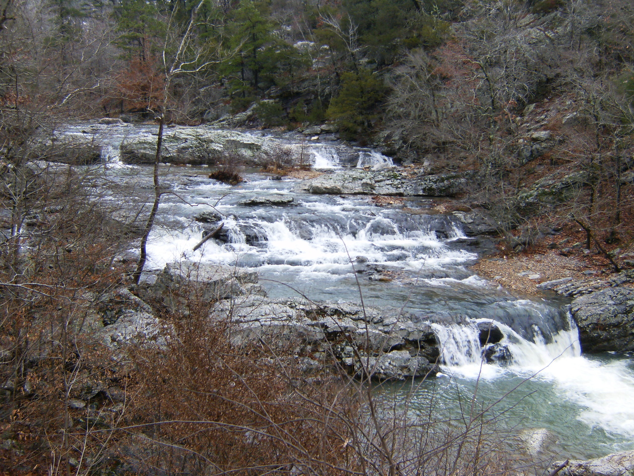
Little Missouri Falls
Another 0.8 miles east gets you to the junction with FR 43. I headed north here along Crooked Creek and up through Mosquito Gap. It’s 4.7 miles from the turn to the intersection with AR 8. FR 43 is rougher (but more scenic) than FR 25.
I didn’t have time to check-out the Albert Pike area but I understand it has reopened for day use – no overnight camping/parking. The Caney Creek Wilderness is also in that area and those trails, with their intriguing topography, are high on my priority list. Of course there’s also the nearby Cossatot River Trail, paralleling one of the best white-water rivers in the area. That’s bound to have some great scenery. Dang, I’ve got a lot to do!


