
The target this weekend was the Ozark Highlands Trail from Ben Hur trail head to the FR1201 (aka Stack Rock) trail head – roughly the eastern half of section 7 and western third of section 8 (maps 13-15). The trail skirts the southern and part of the eastern boundary of the Richland Creek Wilderness. This area features great scenery and very steep terrain in the Falling Water Creek and Richland Creek watersheds.
It was a solo trip with no shuttle so I actually started at the Richland Creek Campground and went out-and-back in both directions over 3 days (Friday-Sunday). Wakeup temperatures Saturday & Sunday were 24 and 23. Friday never got much above 35 but Saturday & Sunday got to about 55 and 60. There were a couple clouds Saturday afternoon but otherwise the skies were clear day & night with an almost-full moon. My face actually got sunburned.
Even the drive in has some great scenery as the road follows Falling Water Creek:

 There’s also the landslide area, where a large part of the bluff collapsed a few years ago and pretty much wiped-out everything below, including the road and the trail. The road was rebuilt and reopened about 2 years ago. The trail has been rerouted above the new bluff.
From the Ben Hur trail head, the trail heads south and soon turns east and across FR 1203 along the top of a ridge before dropping into Jack Jones Hollow. There were four or five small creeks here, and the one main one, all with water. You climb out of that hollow onto another broad relatively level ridge top, across a couple old roads and wildlife ponds before beginning a descent into an unnamed drainage. There’s lots of great scenery in the area of mile marker 139 and beyond as the trail switchbacks steeply down the side of the drainage and crosses it a couple times amidst a jumble of huge boulders and cascades of water. This would be a great area to photograph after a big rain. It would even have been a good photo this time, but I apparently didn’t take one.
The trail then follows a bridge across Falling Water Creek, turns left at the end of the bridge to follow the creek for a ways before crossing FR1205 and FR1219 and then following FR1205 north in the woods well above the road for 4-5 miles.
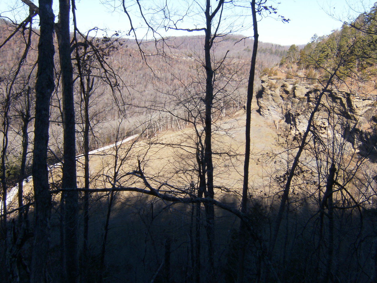
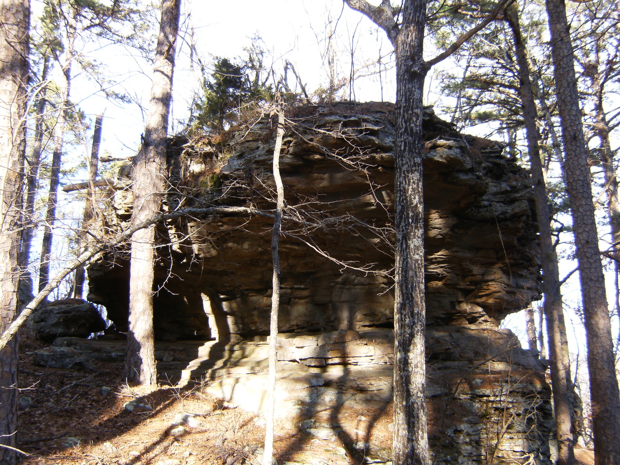
This is a rather nice area up here, below a bluff with some prominent crags, rock gardens, a couple nice creek crossings, and occasional views of Falling Water Creek below, valleys beyond, and the landslide area. One big problem is the south end of the reroute around the landslide. It was apparently done by a Forest Service contractor and much of it is very poorly routed through a steep area – potentially hazardous and likely to erode badly. I believe the OHTA is going to be addressing this in the coming months.
It was up here around around mile 142, I think, that I ran into the only people I would see out on the trail – one familiar and the other not – Jim (Ozark Mountain Hiker) and Bob – on their OHT Quest.

 At about mile 144 you descend back to FR 1205 almost at the entrance to the Richland Creek Campground, turn right across the Richland Creek bridge and up the road about 100 yards before the trail heads into the woods as the road turns sharply left.
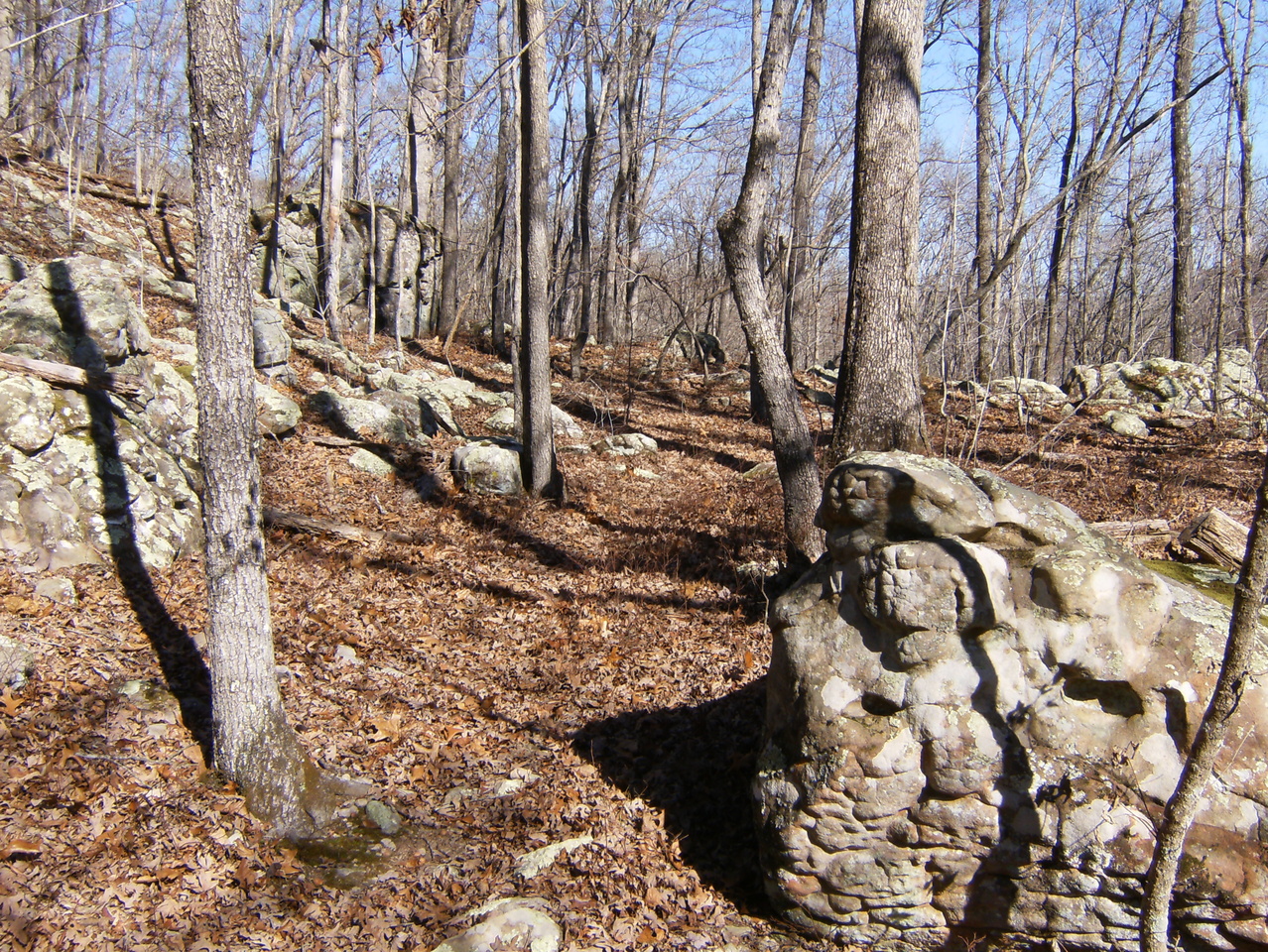
 This trail segment begins by following Richland Creek closely for about a mile before climbing higher and over the next 5 miles traversing a seemingly-endless succession of giant boulders, rock gardens, scenic bluffs, and steep boulder-filled hollows with cascades of water and probably a hidden waterfall or two. The rockiness of the trail made it relatively slow-going and left my ankles feeling very weak by the end of the day. Armstrong and Turnpike Hollows, in particular, are on my list for further exploration and during high water are probably nothing short of breathtaking.


 The trail follows Turnpike Hollow up to near its beginning and then levels-off on top of a ridge for about the last mile, crossing an old road several times before crossing FR 1201 and heading up another road for about 100 yards to the FR1201 trail head.
 Back at the Richland Creek Campground I ran into a couple that was in the area for the first time and looking for a good day hike. They looked familiar and we eventually figured-out that we first met at a Buffalo River trail-building week in Oct 2012. I thought it interesting that the only people I saw this weekend were people I had met before (3 out of 4, anyway). It’s getting to be a small world out there, I guess.


