
Much has happened just east of Tyler Bend in the last month!
Saturday March 15 about a dozen high school students from Russellville came up to spend a day building trail. They were able to get 1/8 mile roughed-in (and some finished) to connect the Grinder’s Ferry area to the existing trail in Tyler Bend! The new trail passes through a 8’x8′ concrete culvert under US-65.
Also on March 15, about a dozen members of the University of Arkansas chapter of Roots and Shoots joined us. They worked in a hollow south east of Grinder’s Ferry, clearing leaves, rocks and stumps from the construction corridor.
On March 22, 16 members of the Ozark Society participated in their semi-annual work day.
March 20-26 brought a group of 14 from University of Illinois for their Alternative Spring Break week, and 5 from the University of Central Arkansas to spend 3 days of their break building trail.
March 30-April 5 was the Buffalo River Alumni week with about 10 people there all week and about 6 more for part of the week.
April 6-12 a small crew (only 2!) from American Hiking Society was in the house.
Many other individuals and small groups and have dropped by for a day or weekend to push us ever closer to completion. We now have usable trail from inside Tyler Bend extending 3+ miles east and approaching Bear Creek. We’re also working from Zack Ridge Road west toward Bear Creek and hope to close that gap this year. There’s already several miles of usable trail east of Zack Ridge Road that would then be connected.
The base camp in Tyler Bend’s Group Campground #1 will remain operational until May 2 with free camping for any trail volunteers. Come, dig, enjoy!
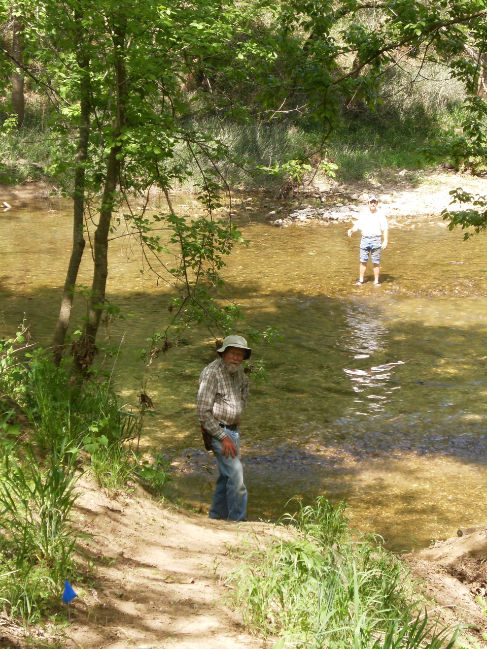
Update: We did indeed get usable tread dug all the way west from Zack Ridge Road to Bear Creek. Here’s Ken Smith at the edge of the creek with Pat D playing in the water. Kudos to Pat – he spent a solid 10 weeks here building trail this spring! He’s one of the reasons we got so much done.
The BRT crossing Bear Creek.
Except for about .5 miles on the west side of Bear Creek, there is now trail from inside Tyler Bend east to Red Bluff Road – about 11 miles. The 5.5 mile section between Red Bluff Road and the South Maumee trail head has a few short gaps that will probably be closed this fall.
The 11.4 miles between South Maumee and Highway 14 has been finished and open for several years. Trails Illustrated map #233 shows these features and roads and I hope someday it will show all our new trail.


Any updates on the trail from Grinder’s ferry to Maumee?
Yeah, check out Buffalo River trail building – Fall ’14 progress report. We’re getting awfully close!
Thanks, how far can we hike if we start at Grinder’s Ferry? Hoping for good weather New Years Day.
You’d hit the first gap near Bear Creek, which would be about 3.5-4 miles. You might find blue ribbons in the trees beyond that point leading a few hundred yards to the creek crossing. There are white metal blazes nailed to a couple trees along the bank on the east side. On the east side of Bear Creek, you should be good all the way to Red Bluff Road – another 6 miles or so. Beyond that, I don’t know.
The bottom line is you could get about 10 miles with a little bushwhacking. There are very few markings along the trail and it hasn’t been mapped.
Thanks for your info. Think we might give it a try, at least to Bear Creek and back.