
I took a break from my westward section hike of the Ouachita Trail to go back and do the east end – Pinnacle Mountain State Park to AR 9 (miles 222.5 to 191.8) and once again, I did it both ways for a 61.4 mile total.
A big problem with the east end, and the biggest reason I’ve put it off, is that only the western 0.7 miles of this 30.7-mile stretch is in the National Forest. The rest is on property owned or controlled by logging companies, Central Arkansas Water, and the state park. There are restrictions on where you can camp and that made the logistics kinda complicated. In addition, the trail starts becoming very “urban” east of AR 10.
The guide book and trail map show spurs to campgrounds at miles 206.8 and 213.2 but as it turns out, those campgrounds no longer exist. There is now one (Penney Campground), on a 0.9 mile spur going east-ish from about mile 208.3. This is the only location you can camp legally in this entire 30-mile stretch, hence my logistical difficulties.
Another change of note is a reroute around what became known as the Scary Bridge at about mile 195.3. The trail now uses the county road bridge so if eastbound, cross that bridge and after about 100 yards you should see a trail sign on the left. If westbound you’ll see the new trail going to the left up a small slope as you get to the old bridge on the right. Follow it out to the road and turn right.
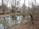
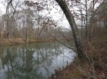
The area between AR 9 and AR 10 is nice – typical Ouachita Mountains stuff in the west (up and down the rocky hills) but in the flat land along the Maumelle River (turning into Lake Maumelle) in the east. It was neat to see the wide and slow-moving parts of the river, lined with big cypress trees, and easy to imagine alligators sunning themselves on the banks, though there aren’t actually any in that area.
Once on the east side of AR 10 the trail goes over the bridge (walking on the east side is easiest) to the north side of Lake Maumelle and soon crosses AR 113 twice, then skirts a residential area before getting off into the woods again for another 6 miles, two crossings of AR 300, then another 5 miles of woods before hitting the mile 217 area. This was where the tornado hit in April ’14. A logging company has cleared the mess and the trail is now open. Continuing east, the trail closely parallels a road being built for a large new high-priced subdivision. I wonder if this will force a re-route in the future. At about mile 219 the trail heads back down close to the lake at the spillway and follows the drainage out to the third crossing of AR 300, and a bridge across the drainage. There is no sidewalk or anything like that here. I suggest crossing the bridge on the east side since you can see the north-bound cars from a greater distance than the south-bound. A short distance later and you’re crossing the Maumelle River downstream from the dam on the old highway bridge which is now open only to foot traffic. Then it’s on to the state park, with the finish line only about 2 miles away.
-
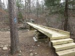
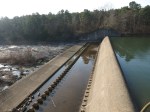
- One of the new bridges, at mile 196.3, I think. It should last a while.
-

- Daffodils at an old home site.
-
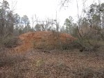
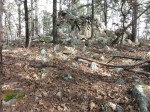
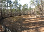
- The gigantic pile of saw dust at mile 206.5.
-
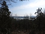
- The “scenic vista” of Pinnacle Mountain at about mile 215
-
- The trail snakes through the tornado damage around mile 217
-
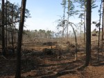
- The aftermath of tornado damage and the cleanup
-
- The new road intuding upon the trail corridor
-
- Lake Maumelle spillway
-
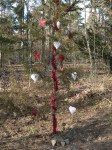
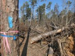
- This was apparently to be a Valentine’s Day surprise for someone
-

- Whew! The end.
I’ve hiked over half of the Ouachita Trail now, and the part east of AR 10 is definitely my least favorite, as I suspected it would be. There are few places where you don’t hear traffic, or dogs barking, etc, and there are many more people on that part of the trail.


The bridge at 196.3 was gone when I walked this section on the 14th of May. The water was low, so no problem to cross the creek. I stopped here to refill my water.
Andrew’s right about the bridge being gone. There’s a detour that will take you out to the road and back again OR you can just take the original path and your chances with the water. Coming from the west to the east, there’s a sign that says “H.W. BYPASS” with arrows pointing to the right to the road. Turn left and take your chances with hopping the creek. (I have no idea what H.W. stands for, by the way.)
H.W. is probably High Water.
That makes so much more sense than anything I was thinking. (HighWay, Hidden Woods, Herbert Walker…)