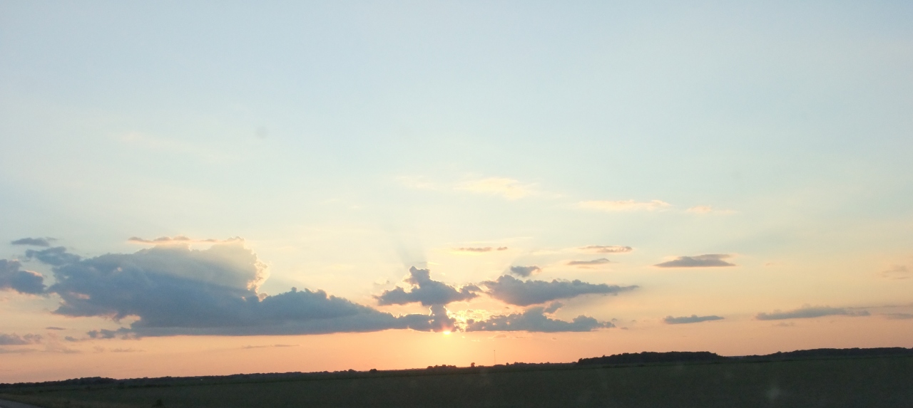
2100 miles, 9 days, 6 states, 527 photos; summer vacation is over. I began by driving east on I-40 and then up I-81 to an area northeast of Roanoke in central Virginia – a route that offered almost all new scenery for me. I spent 4.5 days with family that now live in this area. It’s mostly in the George Washington National Forest and very close to the Appalachian Trail and many others so I was able to do a little hiking. The Blue Ridge Parkway is also very close, with many sightseeing opportunities. Add in some stops on the way home, and I’ve got material for 4 more posts to come ASAP.
Within a span of less than 10 miles, the Blue Ridge Parkway (BRP) passes its lowest and highest points in Virginia – the James River crossing at 650′ and Apple Orchard Mountain at 3950′ (the road doesn’t go over the 4200’+ peak). There are many pull-offs alongside the road and parking lots for the bigger attractions.
-

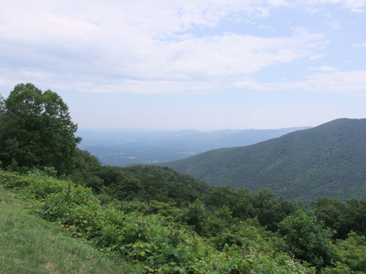
- House Mountain Overlook
-
- House Mountain Overlook
-

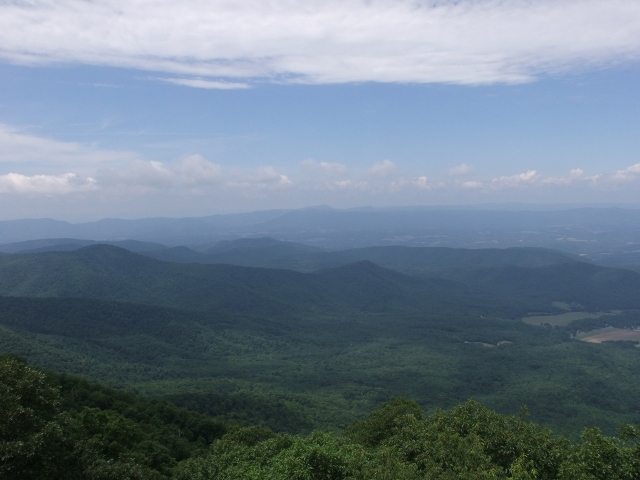
- Thunder Ridge Overlook

-

- Terrapin Mountain Overlook

The James River Foot Bridge is used by hikers of the Appalachian Trail (AT) to cross the James River near the town of Glasgow. At about 700′, it’s the longest pedestrian bridge along the AT and was named in honor of William Foot. There’s a parking area and trail head at the north end, along highway 130.
-

- The Foot Bridge

-

- The James River, looking upstream from the bridge

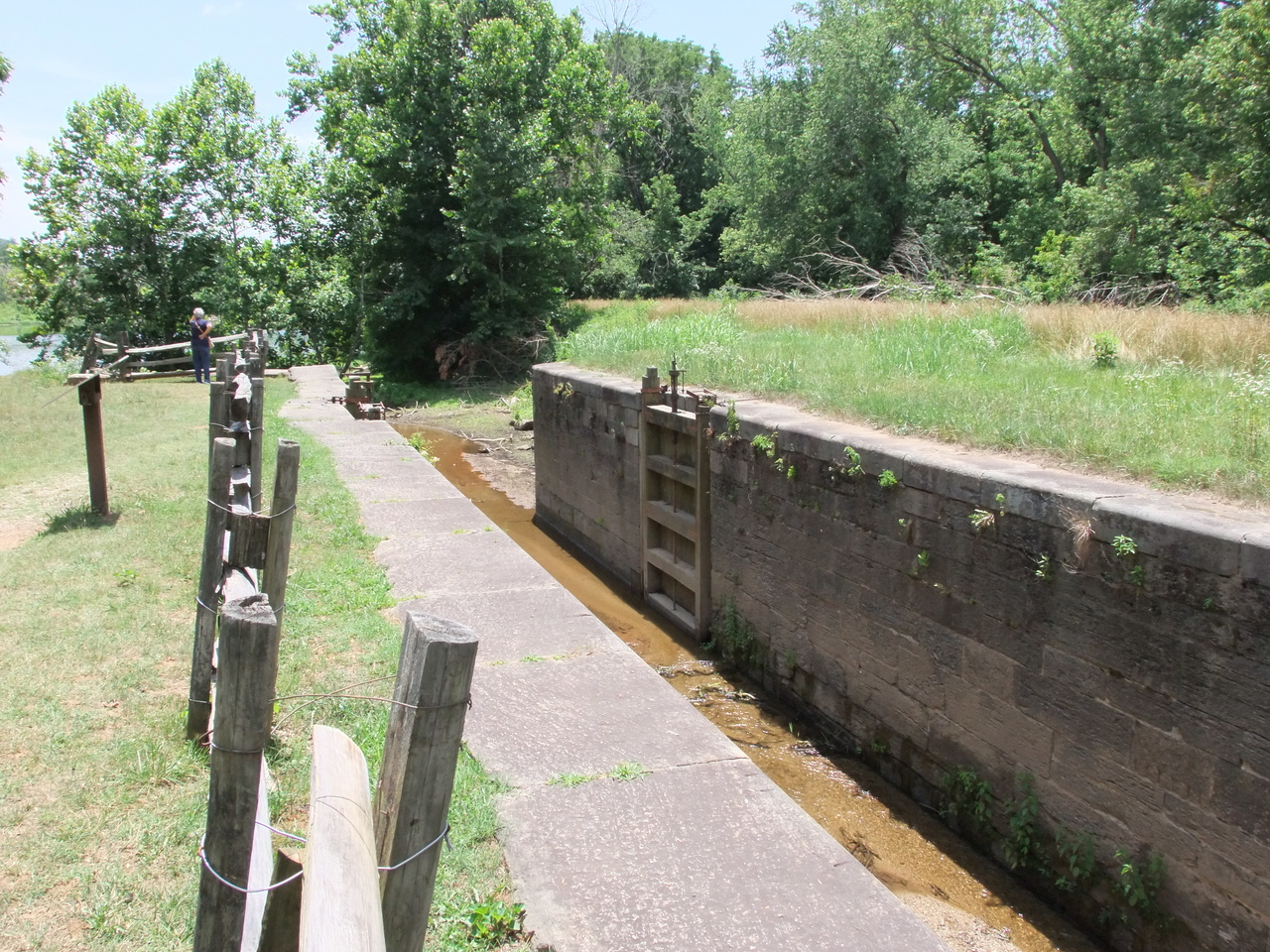
Around 1795, construction of a canal alongside the James River began with the goal of making barge traffic more viable. About 200 miles was eventually completed but by the 1870’s the railroads had pretty much killed it. One of the 98 locks has been preserved near the James River Visitor Center where the BRP crosses the river. The amount of labor required to build this system is mind-boggling.


Crabtree Falls is one of the tallest waterfalls in the east. It has a total drop of about 1200′ over 5 major cascades with the biggest being about 400′. You cannot see or photograph the whole thing at once from the ground. The lowest cascade is wheelchair-accessible and only about 500′ from the parking lot. There are 3 higher overlook areas reached via a natural-surface trail and wooden stairs. The trail continues past the falls to intersect the AT after about 3 miles. I only went up to the second overlook and didn’t see the biggest of the falls.
-

- The lowest cascade

-

- The view from the second overlook

The drive home took me into West Virginia for a look at the New River Gorge, through Kentucky for a day of hiking in the Red River Gorge Geological Area, a tour of Mammoth Cave, and a transit of the Land Between The Lakes. From there I drove southwest across a corner of Tennessee, Missouri’s boot heel, and northeast Arkansas – mostly on US and state highways where I could see the interesting bits of America you don’t see from the interstate.