
Colorado’s West Elk Wilderness covers over 176K acres of the Gunnison National Forest north of Gunnison and west of Crested Butte. Outdoor Trail Maps LLC has a good map of the area. See also Trails Illustrated maps # 133 and 134 for less-accurate alternatives.
Some friends and I did a 5-day, 24-mile “lollipop” starting July 25 at the Cliff Creek trail head on County Road 12 aka Kebler Pass Road, headed south over Beckwith Pass into a counter-clockwise loop consisting of the remainder of the Cliff Creek trail, Castle Creek trail, and Lowline trail, then back north over Beckwith Pass to return to the trail head July 29.
The trail between the Cliff Creek trail head and Beckwith Pass seems to be pretty popular with day-hikers but as soon as we got over the pass we could see that there had been much less traffic. The area has a reputation for being little-used by backpackers and we saw only 2 others, near Castle Pass, the whole time.
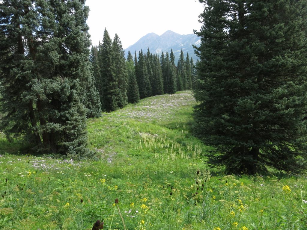
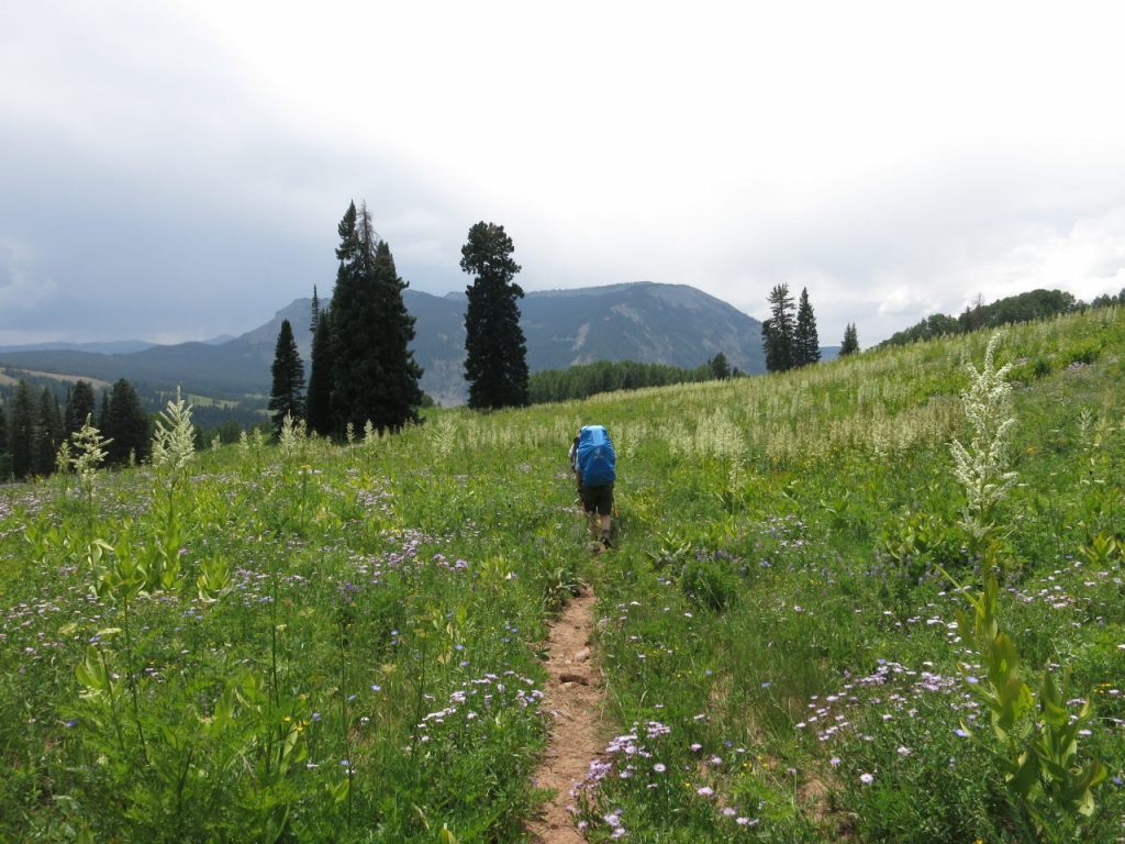
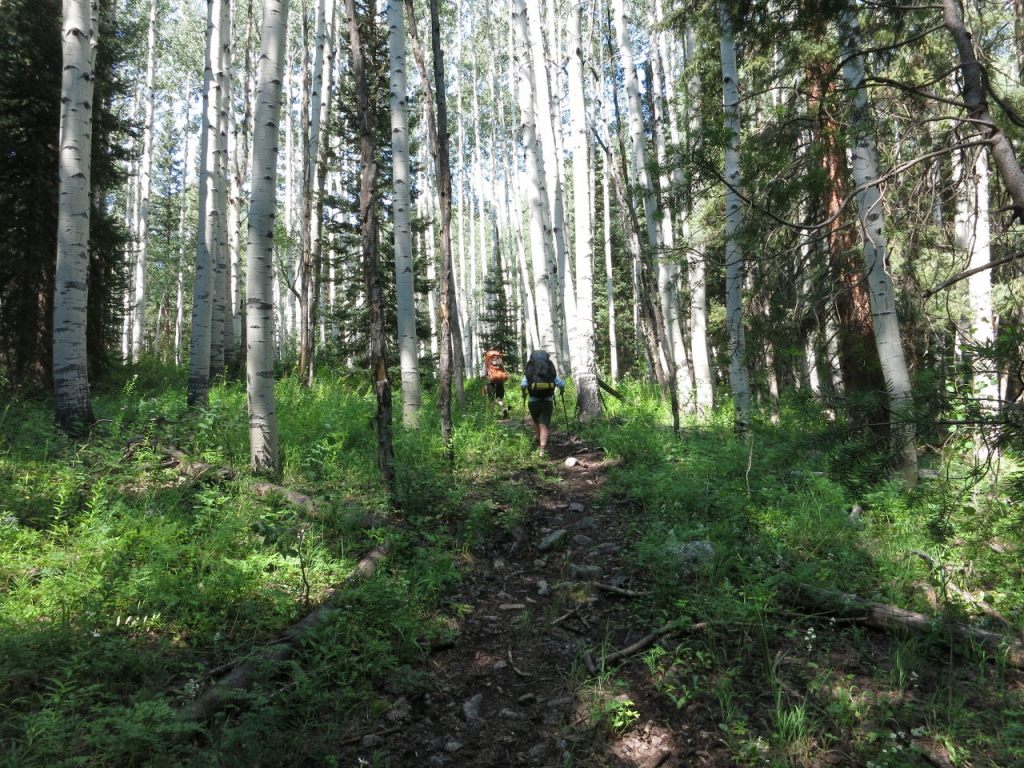
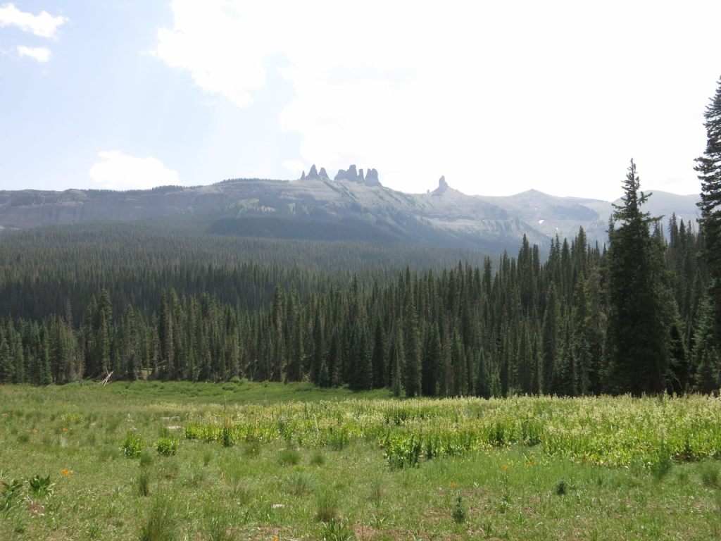
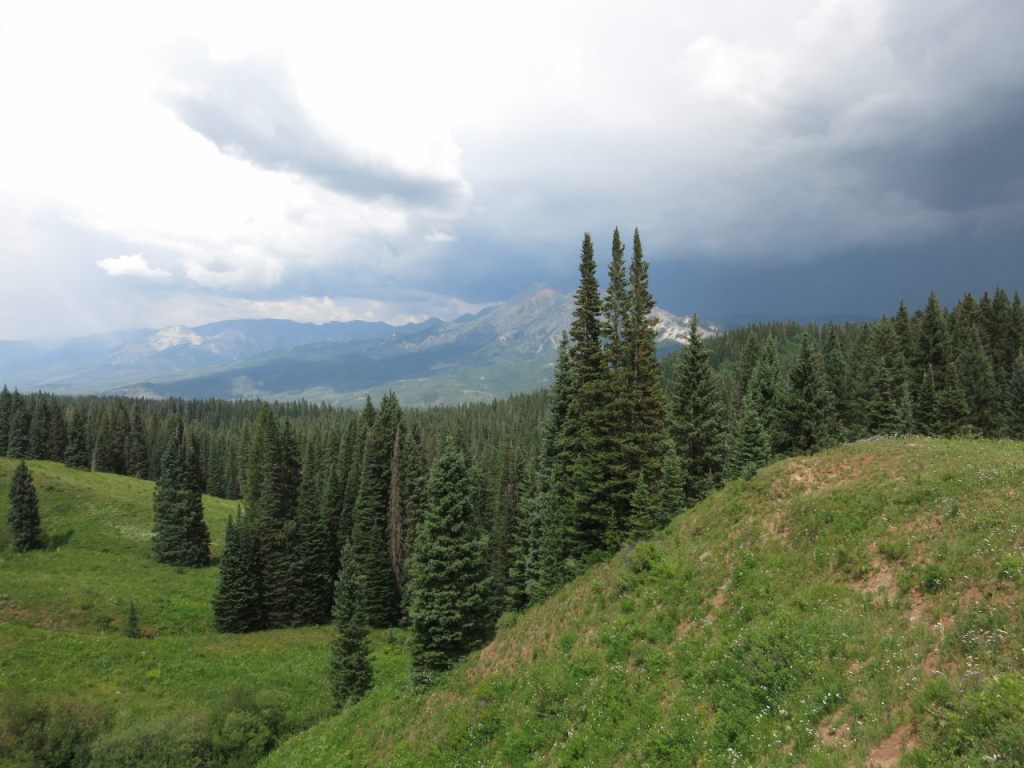
The area was notable for the expansive meadows filled with wildflowers, the large population of Aspen, and the seeming lack of pine beetle damage. It seemed like we were always hiking either up hill or down (and it felt like it was about 90% up hill and 10% down). Camp sites for our group of 4 tents were relatively difficult to find. A couple nights had us crowded into a small space and being glad to have found that. Weather was not bad for monsoon season. We had some rain the afternoon of days 1 and 4 and during several nights. High temps were in the low 80’s and lows were upper 40’s – low 50’s.
Day 1: Climb south from the Cliff Creek trail head about 2.5 miles over Beckwith Pass and into the West Elk Wilderness. Descended to junction with Lowline trail. Continued southwest on Cliff Creek trail about a mile in a light rain. Camped in an Aspen grove before crossing Cliff Creek.


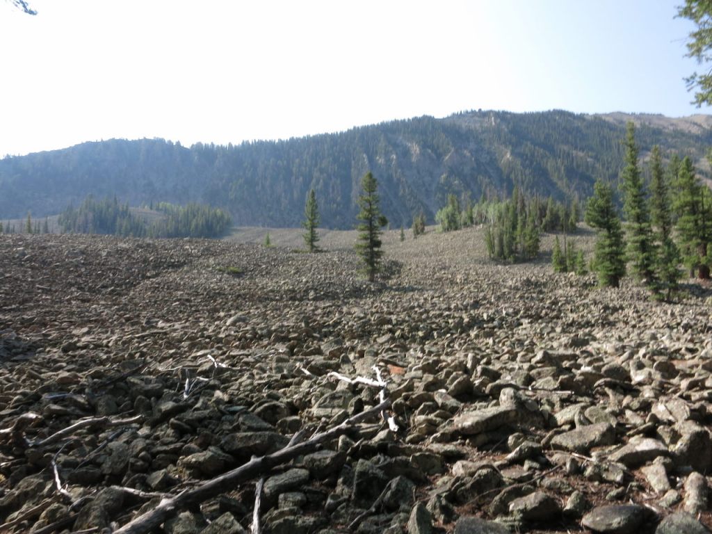
Day 2: Continued southwest on Cliff Creek trail. Encountered an extensive scree field. Took a wrong turn on trail #851 – the TI maps are incorrect in this area. Headed south to junction with Castle Creek trail, then east on Castle Creek trail. We finished the day by climbing a long series of switchbacks to the ridge. It wiped us out but we were glad to have that behind us. Camped along the ridge.
Day 3: I scared away an elk cow and calf that were grazing just over a small ridge from our camp. We continued east on Castle Creek trail up the ridge and over Castle Pass. Started catching glimpses of “The Castles” as we descended to the junction with Lowline trail. Turned north about a mile to an unnamed lake where we camped for the night. While we ate dinner, a bull moose passed within 50 yards of us on his way to the lake.


Day 4: Saw a moose cow eating breakfast in the lake with a calf just up the slope. Continued hiking northwest on the Lowline trail.
After crossing Pass Creek the Lowline trail kinda disappears and the visible path is instead a branch of the Pass Creek trail that is not on the TI maps. Don’t follow that trail as it turns east! Stick with a north heading through the grass and the trail reappears after about 100 yards at a rocky slope.
We continue north through the Swampy Pass area, descended northwest to the Cliff Creek trail junction, then north on the Cliff Creek trail out of the Wilderness and over Beckwith Pass (with black clouds closing in from the east). Started raining. Found a make-do camp site, then stood in the rain until it stopped and we could set up camp.


Day 5: Hiked out. From the trail head we drove west and made a stop at Black Canyon of the Gunnison National Park (north rim), the topic of the next post.


hi. is most of the west elk trail hiking in heavy forest? thanks
Our loop included some pretty large open meadows.