

The Lost Creek Wilderness covers about 120K acres of the Pike-San Isabel National Forest northwest of Colorado Springs and southwest of Denver. It’s a popular place due to its proximity to those population centers.
The recently-retired TC and I did this 20-mile loop in the southern part of the Wilderness over 3.5 days. We had pretty good weather – mostly clear skies with no rain. A high of about 90F on day 1 but only about 80F on the other days. Lows in the 38-45F range made for great sleeping. A full moon made the headlamp redundant.
We were accompanied on the way out by DM (aka “Kemo”), a friend who was to begin a through-hike of the Colorado Trail the next day. We dropped him in Colorado Springs where he had a ride to Denver, while we headed into the mountains for the Goose Creek campground – a small oasis within the destruction of the Hayman Fire of 2002.
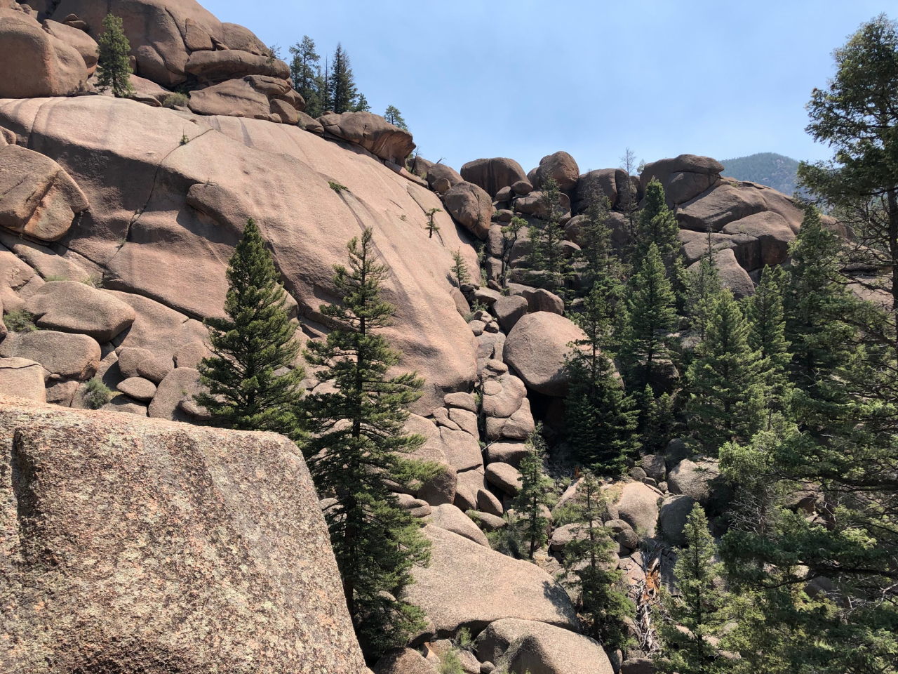
Monday: We drove the short distance to the trail head (8222′), then headed north on the Goose Creek Trail. Within 10 minutes of leaving the trail head there is no more sign of the old fire. The woods are rather open, with a lot of sun exposure. There are a lot of logs on the ground – enough to make off-trail travel difficult – but the forest seems very healthy, with no sign of pine beetles. The geology is mostly, if not entirely, granite and very weathered. There are many interesting formations like balanced rocks, mushroom rocks, etc.


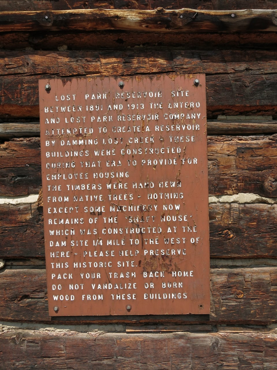
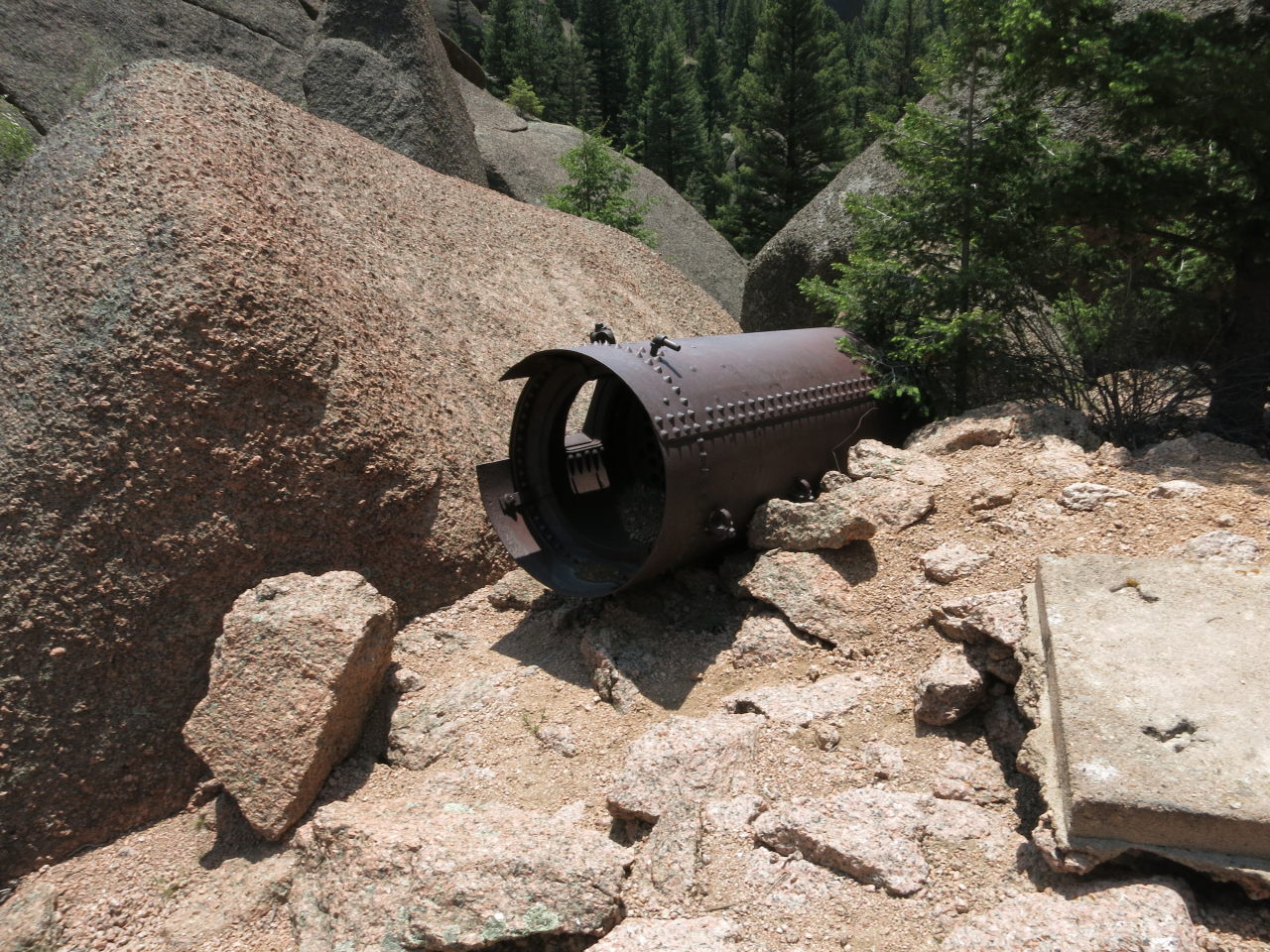
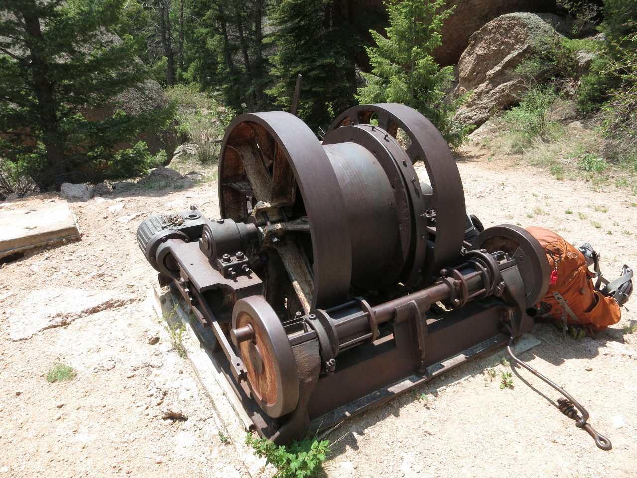
Lost Creek got its name not from being remote or someone forgetting where it was, but from its tendency to go underground at several locations, reemerging some distance downstream. At one of these locations more than a hundred years ago, a company tried to sink a shaft to the subterranean stream to block it and create a reservoir. I guess they thought it would be simpler than just building a dam but they gave up after more than 20 years.
About 3.5 miles from the trail head we came to the spur for “The Shafthouse”. This leads past the old crew quarters about 3/4-mile to the actual worksite, where some equipment was left behind.

Back on the main trail, we hiked north another 1.25 miles to camp in Reservoir Gulch – an area that presumably would be underwater had the damming succeeded.
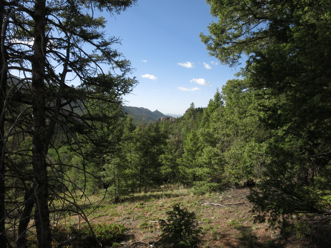
Tuesday: We start the day with a climb to 9430′ and the junction with McCurdy Park Trail, where we turn west. This trail was said to have some of the best scenery in the Wilderness, and it was pretty good. After taking my first 2 photos of the day my camera broke, with the lens refusing to retract. Fortunately TC had a little power left in his phone so he was able to take a few pictures.
The trail immediately drops about 500′ into Refrigerator Gulch then has smaller ups and downs through 2 more drainages before dropping into a valley where Lost Creek emerges from underground. We had lunch in a shady spot next to the creek.
After lunch we followed the trail very steeply up the pile of boulders the creek goes through, and then very steeply down the other side to where the creek disappears.


From there the trail follows the creek a little upstream before crossing it at 9000′ and beginning the “death of a thousand cuts” that is the climb to McCurdy Park. This is a seemingly-endless series of switchbacks that finally comes back alongside the creek and begins leveling out at about 10300′. There are several campsites there but they were all occupied so we had to climb a couple hundred feet more before finding something suitable at about 7:30 PM. That was a long, tiring day!
Wednesday: We climb the remaining 400′ to McCurdy Pass (10900′), then begin a long descent to about 8900′. We hoped to take the Lake Park route but had to skip it because I was climbing way too slowly. During the descent we see many signs of civilization to the west, outside the Wilderness. We turn southeast onto the Hankins Pass Trail, climb past the Lizard Rock junction, then turn east and climb all afternoon to Hankins Pass (10000′). This is a very happy place as from here it’s downhill all the way back to the trail head. We make camp about .4 miles past the pass.
Thursday: We hiked out the final 4 miles on the Hankins Pass Trail. The middle couple miles of this trail are in large open grassy areas, the lower part in dense woods and crossing the creek numerous times. At about 1/2-mile from the trail head we began seeing the fire damage and know we’re getting close.
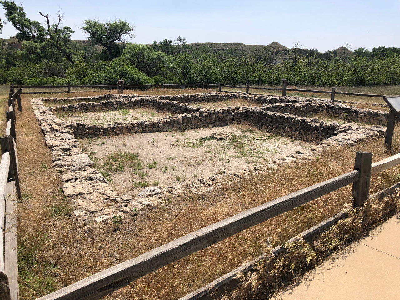
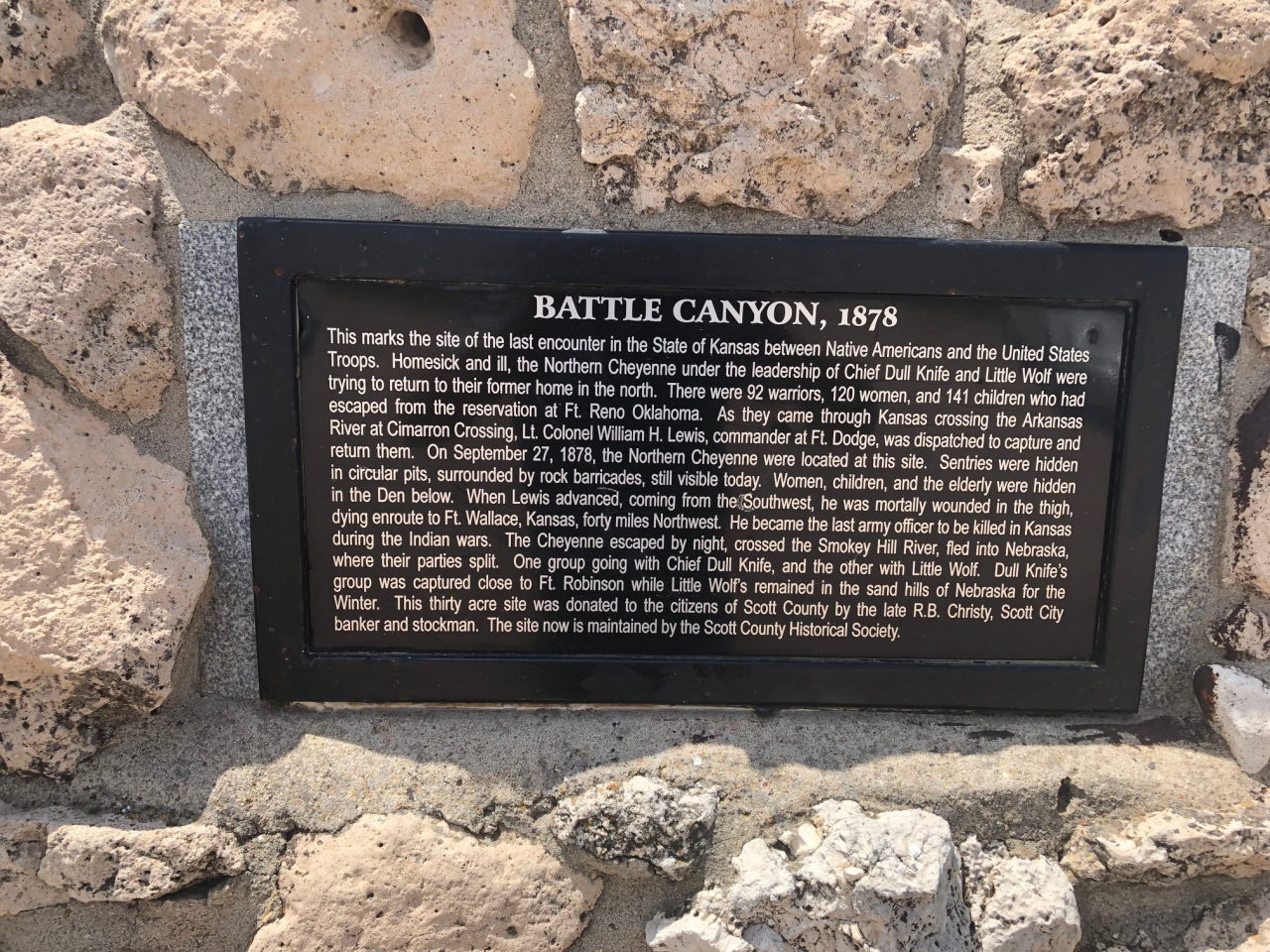
Following a great lunch at the Hungry Bear in Woodland Park CO we headed east toward home. We spent the night in a motel in Limon CO before continuing east on I-70 in the morning. At Oakley KS we took a series of side-trips to the south – Monument Rocks and Little Jerusalem Badlands State Park for the Niobrara chalk formations, Lake Scott State Park to see the remains of the northern- and eastern-most Pueblo site yet found, Punished Woman’s Fork to see the site of the last “indian battle” in Kansas (fortunately most of them got away), and finally over to Great Bend to see Cheyenne Bottoms, a rather famous wetlands area that was conspicuously dry.
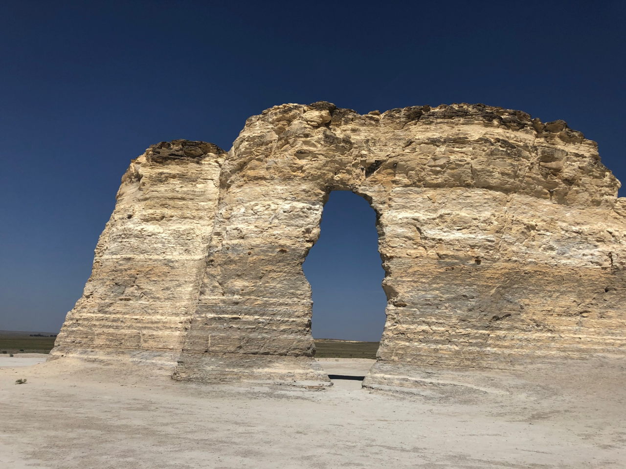
Monument Rocks


As for the camera, I’ve ordered a Fujifilm XP140. Optically, it’s not as good as the old Canon S110 but the XP140 is waterproof and dustproof so it might prove a better choice for backpacking. July 7 2022 update: The XP140 was a mistake – there were a lot of compromises that I thought I would be able to live with but couldn’t once I got my hands on it. I’ve settled on an Olympus TG-6. Optically and feature-wise it’s almost a match for the Canon S110 but is waterproof and dustproof.


On Thursday and Friday I passed through Lost Creek Wilderness on the Colorado Trail. The Colorado Trail merges with the Brookside/McCurdy Trail for a few miles.
– DM