
I hiked the 29.5 mile OHT section from Ozone to Lick Branch trail heads this weekend with a couple other guys. They both had long drives so after dropping a car Thursday afternoon at Lick Branch we hiked in from the Ozone trail head to just past Boomer Branch creek before setting-up camp near mile 81.5 as it got dark.
Friday got off to a sunny start as we fought our way to Brushy Ridge through a couple miles of thick brush and briars but then the sky clouded-over. By 2:30PM our 20% chance of rain started actually falling and continued until sometime early Saturday morning. The GoreTex in my boots failed long ago (just like all my older “waterproof” boots) so my feet were quickly soaked just from walking through wet brush and then a long sweaty climb toward Arbaugh Road left us just as wet inside our rain gear as outside. We made camp at the top of a small drainage just west of the road, again as it was getting dark, after putting in about 11 miles for the day. Fortunately, the rain was light as I set up the tent so it didn’t get very wet inside. I need to work on my technique for packing & unpacking in the rain because I won’t always be so lucky. We cooked dinner and ate under a cedar tree and were headed for bed by 8:00 PM.
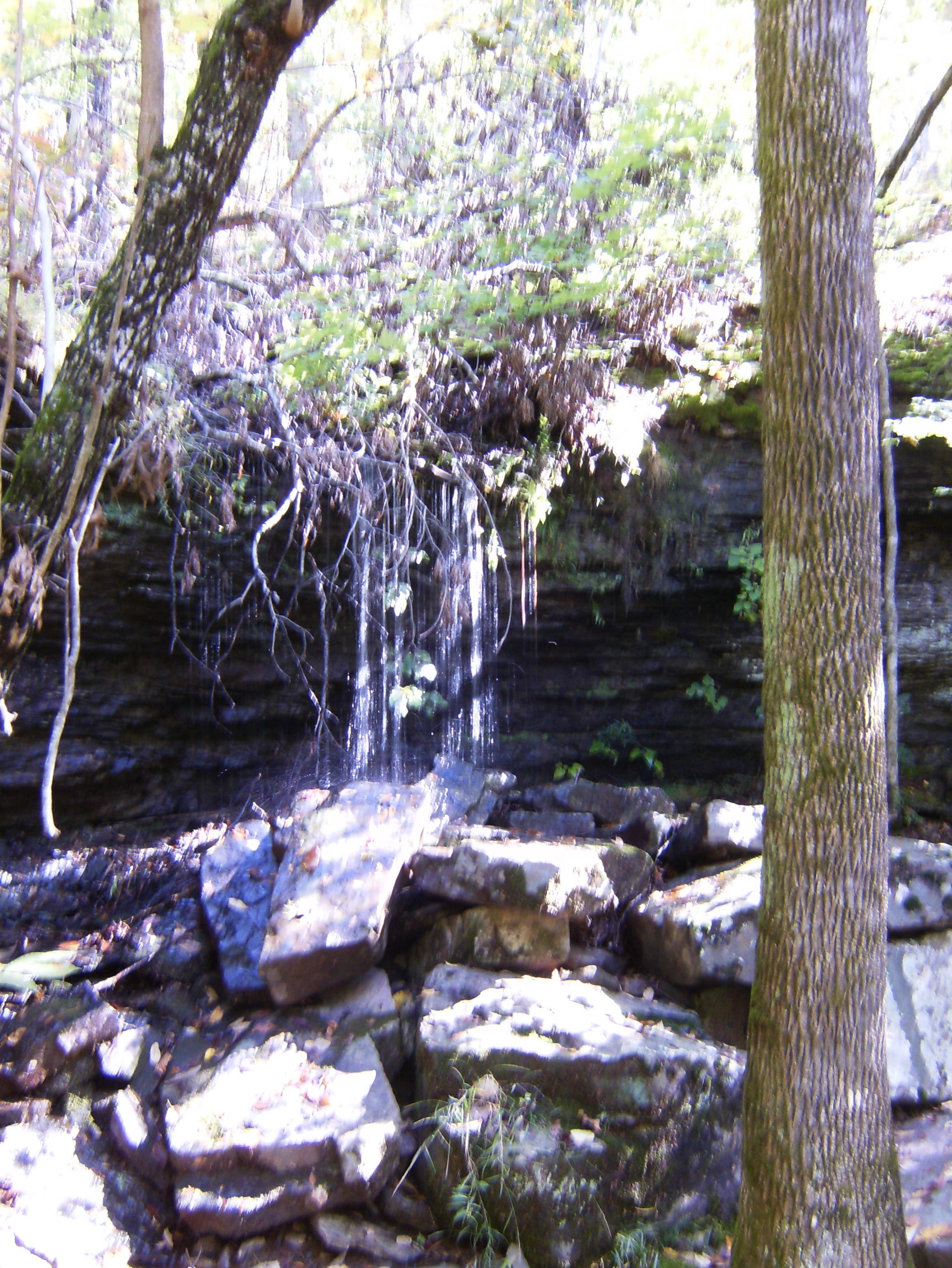
Saturday dawned chilly and foggy and instead of drying overnight, some of our gear was even wetter! What a way to start the day. The silver lining to Friday’s discomfort was the increased water flow in all the creeks so once we got on the trail and the fog lifted we were treated to many waterfalls. The most spectacular was just a couple hundred yards west of our camp, in fact, as the unnamed drainage we slept next too plunged into a ravine in four falls of maybe 5, 20, 20, and 5 feet respectively.
 There was much more to see in Lynn Hollow and Eldridge Hollow – there’s some pretty good day hikes and sightseeing trips to be had there, I think. My crappy camera couldn’t get good pix in the low light under the forest canopy so you’ll have to see them for yourself.

 We ended the day traversing the ridge of Miller Mountain with a very nice view of the Little Mulberry Creek valley from a crag at about mile 61.5.
  Our camp near mile marker 60 was our first in an established site complete with fire ring and furniture and we arrived early enough this time to get our wet stuff hung out to dry a little more and to enjoy a nice sunset at dinner time. The camp fire never amounted to much due to damp wood but it kept us busy.
Sunday sunrise revealed a fog-filled valley below, blue skies above, dry pants and socks, and merely-damp boots. A great start. We hiked-out about 4 miles to our vehicle at Lick Branch and headed for the Ozone trail head with a stop for a great lunch at the Oark General Store – a must-see if you’re in the area.
I’ve now hiked more than half of the main trail and expect to hike the rest of it before next summer – including the Sylamore section. I might even re-hike parts done in prior seasons so that I can brag about doing the whole thing in one season.


