
This was a 3-day trip with RC (hike in to Island Lake, day-hike, hike out) and was part 2 of our 2023 Wind River trip. The planned day hike was either A) up onto the ridge south of Silas Canyon and out to the Stough Basin overlook, or B) farther up Silas Canyon to the other lakes.
Ben Adkinson’s book has a good description (#32 in 3rd edition) and the map from Beartooth Publishing can be useful. Nancy Pallister describes some portions in her “Atlantic Canyon” and “Stough Creek Basin and Silas Canyon” routes and includes maps depicting the bushwhacks involved.
Our trip began at the Christina Lake trail head (9400′), which is actually adjacent to Fiddlers Lake and several miles from Christina Lake. The trail head is on FR300, about 15 miles south of the Sinks Canyon campground and about 13 miles north of WY-28. We heard this trail was popular with the locals on weekends so we weren’t expecting total solitude but were still surprised to find 30-40 cars at the trail head Saturday AM.
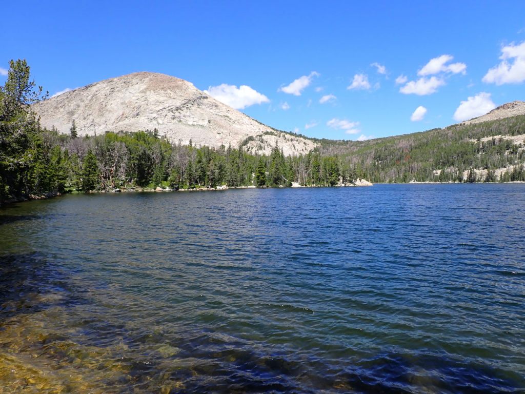
Day 1: The objective was to hike up Silas Canyon to Island Lake – a 1200′ elevation gain over about 5 miles. We followed the Christina Lake Trail 1.8 miles west to a signed junction, then turned right/northwest on the Silas Canyon Trail, crossing into the Popo Agie Wilderness shortly afterward. The Silas Canyon Trail crossed the inlet to Lower Silas Lake, passed a south-bound spur to Tomahawk Lake, and after about 2 miles skirted the south shore of Upper Silas Lake where we stopped for a leisurely lunch.
We expected the hiking to be pretty easy after already spending a week acclimating but were disappointed at being passed by many other people while continually stopping to catch our breath.
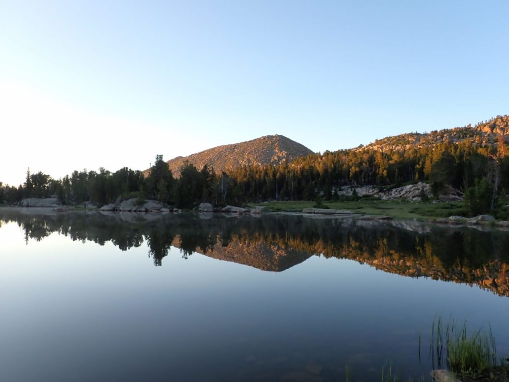
After lunch we continued along the shoreline and found the social trail to Island Lake right where it was expected. This social trail was pretty worn and easy to follow. We hiked past a lot of Island Lake before we ever saw it, arriving at the southwest end among a large patch of willows along the inlet stream. We tried several paths through the willows before finding one that didn’t require wading and made our way down to the shoreline and a decent camp site.
One big disappointment we had was the sheer amount of trash – in the fire ring and small bits all over the camp site. This was a theme at the other campsites we saw around Island Lake as well. From our fire ring I pulled out a *lot* of aluminum foil, uncooked chunks of ramen noodles, and a ruptured propane cannister. I packed them out and disposed of them properly. It’s too bad “the locals” don’t seem to give a crap.

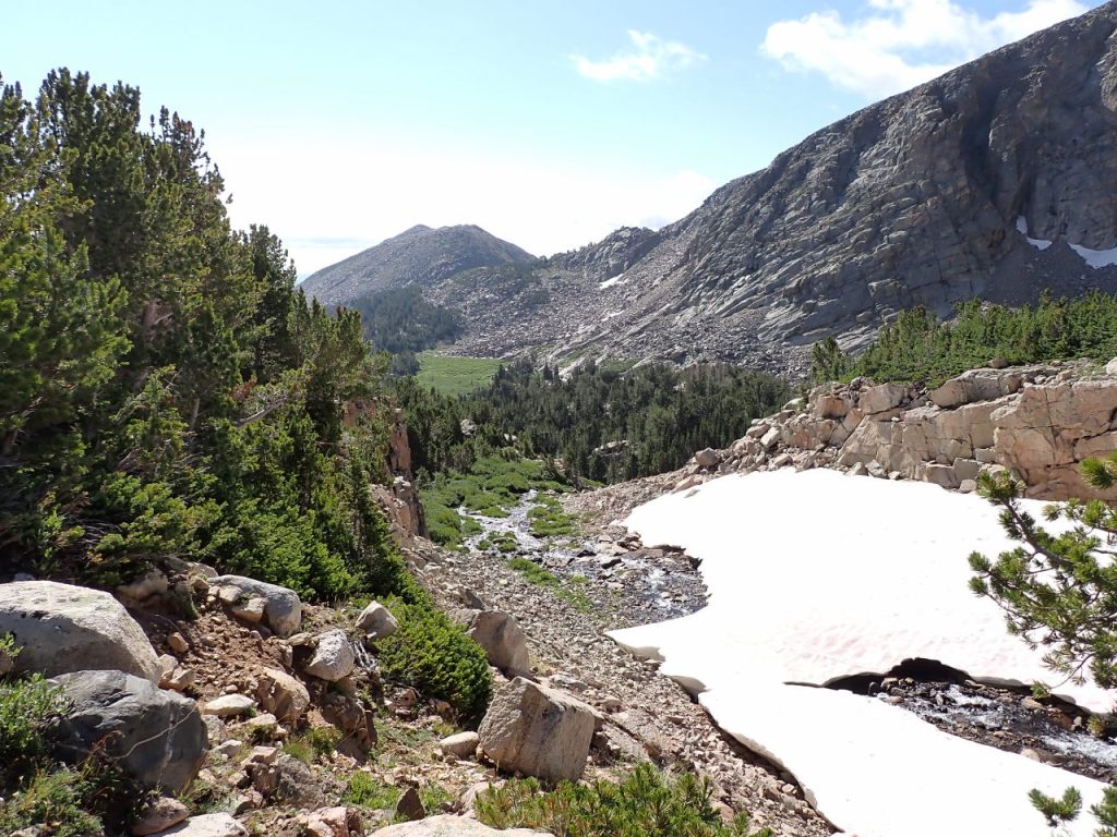
Day 2: We awoke to clear blue skies but while eating breakfast noticed dark clouds rolling over the ridge to the north and wondered if the day would be a wash-out. We eventually noticed the clouds were dissipating shortly after coming over the ridge so perhaps weren’t a threat. That behavior continued much of the day but we didn’t have a drop of rain. We decided against the Stough Basin overlook day hike and opted to go farther up Silas Canyon instead. The social trail roughly follows Island Lake’s southern inlet stream up to Thumb Lake, though on higher ground (100′-200′?) alongside the channel. The path is braided and in some places indistinct but keep the drainage to your left and you’re guaranteed to run into Thumb Lake. It’s about .8 miles with a 400′ elevation gain (to 11000′).
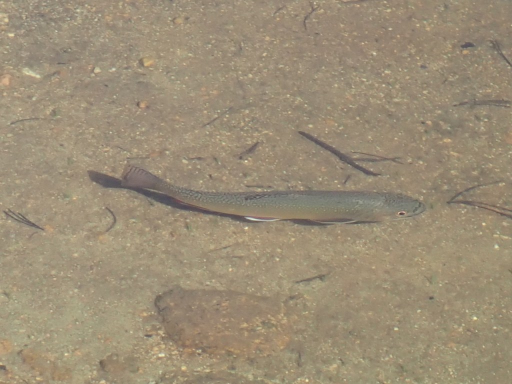
Thumb Lake is shaped like a mitten so it’s easy to see how it got the name. There is very sparse vegetative cover so I expect very few camp here. We encountered two pairs of people fishing and one hiker coming back from the upper lakes. There are said to be Golden Trout here.
We made our way around the north side of Thumb Lake and up its inlet stream to the next (unnamed) lake, about .25 miles and +50′.
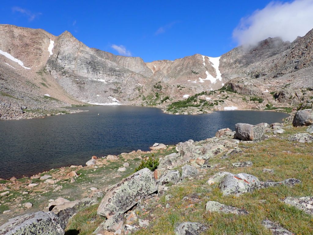
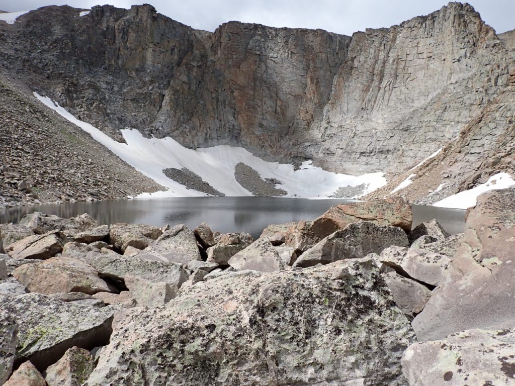
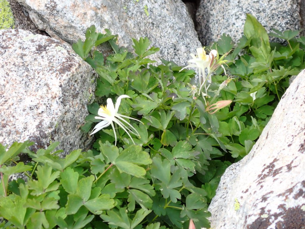
Skirting the south side of the unnamed lake and hiking another .5 miles and +230′ across slabs and then boulder-hopping got us to the very scenic LF Lake at 11280′ and the head of the canyon. There were a couple waterfowl in the lake and it still had some ice along the edges at the upper end. A great place for lunch, even if a bit windy. There were lots of columbine growing among the boulders.
We got back to camp by about 2 PM and spent some time simply sitting. It seemed like most people had left (it was Sunday afternoon) and the lake was very quiet. We explored the west side of the lake.

Day 3: The hike out was uneventful. We stopped for a break at Upper Silas Lake and watched the small trout in the shallows. Back at the trail head, there were now just 3 cars in the parking lot.
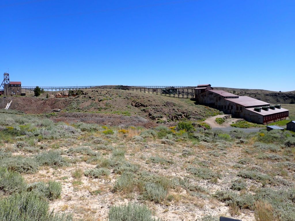
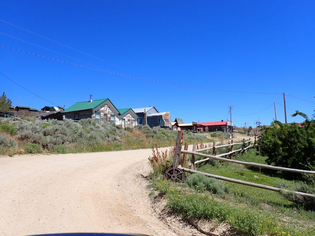
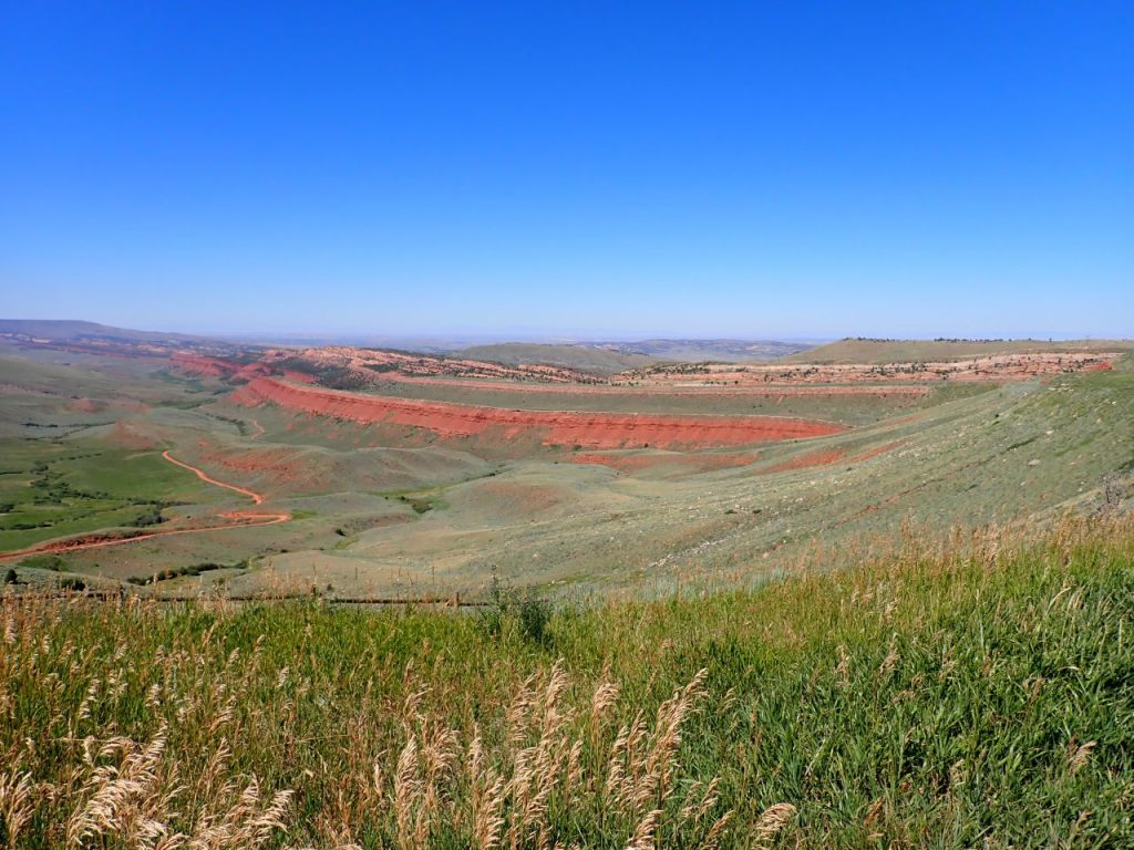
After-trip: We drove south from the trail head to WY-28 – all new territory for us – as the scenery changed from forest to scrub land. At the highway we went a little SW to South Pass City, an old mining town and then NE to Atlantic City – another old mining town that is still populated – where we had lunch at the Mercantile. We ran across a guy that was riding the Great Divide Mountain Bike Route and offered to buy him lunch but he was looking for food he could eat while in the saddle. We continued NE on WY-28 past the Red Canyon area before hitting WY-287 coming south from Lander. After that it was the usual drive south to Rawlins and then east on I-80.


Beautiful Michael!!
Your description was great as always. Especially enjoyed the pictures. Beautiful!!
Wind River is such a beautiful place.